

A day from Market Street toward the Mission can reveal how San Francisco’s civic spine, arts institutions, transit, food businesses, and living cultural districts overlap. It can also become a careless checklist that treats murals, language, restaurants, and residents as visual samples. The difference is context: know the places you are entering, choose a few specific institutions or businesses, and leave time to see the streets between them.
This is not a fixed food crawl. It is a planning framework for one Market Street anchor, one deliberate corridor into the Mission, one meal or maker stop, and one public-space release. Check each business, institution, event, and transit operator for current information.

Chinatown, North Beach, Little Italy: 7 Tastings & History
Spend an afternoon exploring two of San Francisco's vibrant areas for food and nightlife on a walking tour through Chinatown and North Beach. On their...
Start with a civic or cultural anchor
Market Street crosses multiple parts of the city and changes character along the way. Select a defined starting area rather than treating the entire street as one scene. An architecture question, museum, library, performance, public artwork with documented context, or transit connection can provide the anchor.
Notice how the diagonal disrupts the surrounding grid. Transit lines gather; side streets change width; civic spaces open and close; older and newer buildings create competing scales. This structural reading helps you understand why a short move south can feel like a larger transition.

Name the part of SoMa you cross
“South of Market” covers far more than a few blocks near a museum or convention center. Housing, hotels, warehouses, arts spaces, nightlife, social services, Filipino cultural institutions, offices, and redevelopment pressures sit across a large district. If your route passes through, name the actual streets and destination rather than using SoMa as one generic transition zone.
SoMa Pilipinas and other City-recognized cultural districts practice place-keeping in neighborhoods shaped by displacement and change. Their names and symbols are not a design resource to lift out of context. Use the district or organization’s own public material to understand events, businesses, history, and visitor conduct.
Choose a corridor into the Mission
Mission Street and Valencia Street run parallel for part of the district but do different work. Mission Street carries dense transit, retail, services, restaurants, and deep Latino community histories. Valencia has its own mix of businesses, housing, restaurants, nightlife, and cycles of change. Walking a measured section of each can make the contrast visible, but do not narrate one as “real” and the other as its opposite.
Use cross streets to connect them when the grade, traffic, and your energy make sense. Let the route serve the destination: a bookstore, market, bakery, restaurant, gallery, community institution, or park. Do not choose the longest possible line simply to say you covered the neighborhood.
Approach food as a relationship to place
A famous dish does not summarize a community, and a queue does not create a right to occupy the sidewalk. Choose one or two stops that genuinely interest you. Read the business’s own description when available, understand whether reservations or ordering systems apply, and have an alternative nearby. If a place is overwhelmed, the considerate choice may be to return another time.
Photograph food without turning staff or other diners into an unasked-for backdrop. Ask before documenting a person at work or a small interior. Tip and pay according to the business’s practice. Avoid describing an affordable meal as a discovery made possible by ignoring the people who made it.
Markets and bakeries can provide a lighter stop, but they remain working businesses. Keep entrances, displays, and payment lines clear. If you are taking food to a public space, carry out everything you brought and follow current park rules.
Murals need authors and context
Mission District murals are frequently presented as a free outdoor pattern library. Many are authored works tied to specific histories, organizations, buildings, political struggles, memorials, or community programs. Before photographing closely or publishing an image, identify the artist and site guidance where possible. Do not crop a symbol or face into generic branding.
A contextual walk may include a mural organization, cultural district, or guided program that explains the work and supports its stewardship. If you encounter art incidentally, look without blocking the sidewalk or a doorway. A wide documentary view of a street is different from reproducing a protected artwork as the main subject; rights can be more complex than the photographer’s license alone.

San Francisco to Muir Woods Shuttle
We are the only company in San Francisco offering a round-trip, direct shuttle from San Francisco to the majestic Re...
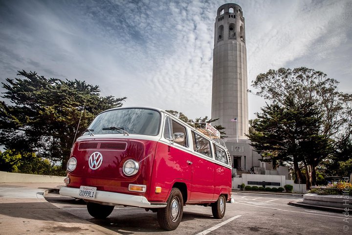
Vantigo - The Original San Francisco VW Bus Tour
Looking for an authentic San Francisco experience? Trade the tour bus for a vintage Volkswagen van that easily navig...

Alcatraz Inside Access Ferry and Audio Tour with Night Option
Explore Alcatraz Island like never before with this exclusive package that includes official admission and round-tri...
Use public space as the release
Dolores Park is a familiar option, but it is not guaranteed to be quiet, empty, or comfortable in every condition. Other small parks, plazas, libraries, and indoor public spaces may fit better. Choose a release that reduces the number of decisions and provides the facilities or transit connection you need.
Public space reveals the relationship between corridors. From an edge or slope you may understand where Market runs, where the central hills rise, and why weather differs across the city. Keep that orientation, then take a direct route home instead of adding one more distant district.
- Market anchor: one civic, architectural, or cultural destination with enough time to engage it.
- Named transition: a specific section of SoMa and a direct transit or walking connection.
- Mission corridor: a measured section of Mission or Valencia, crossed with purpose rather than comparison hunting.
- Food or maker stop: one place you chose for its work, not as a token.
- Public release: a park, library, plaza, or simple transit ride that closes the route.
Context desk

San Francisco Excursion: Guided Tour to Muir Woods and Sausalito
Experience the awe and wonder of one of California's oldest redwood groves as you stroll through dedicated paths o...

Napa and Sonoma Half-Day Wine Tour with Guide and Tastings
Savor the flavors of California’s world-famous wine country on a relaxing half-day adventure from San Francisco. T...

Muir Woods and Sausalito Small Group Tour
This tour will visit Muir Woods and Sausalito. Note that this tour includes the Muir Woods entrance fee. We provide...
Chinatown, North Beach, Little Italy: 7 Tastings & History
Spend an afternoon exploring two of San Francisco's vibrant areas for food and nightlife on a walking tour through Chinatown and North Beach. On their...

Read the City’s Cultural Districts Program and follow the relevant district or institution’s own current guidance. Use SFMTA for live transit. This guide does not reproduce business hours, prices, event schedules, or reservations.